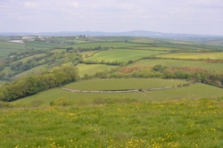
 The view above Looe
 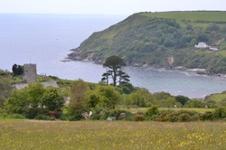 Talland Bay
 Talland Bay has been encroached by the sea over the centuries and the beach used to be much further out.
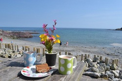 Talland beach
 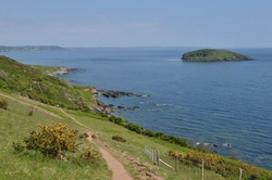 South West Coast Path and Looe Island
 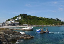 East Looe and the banjo pier
 The view above Looe The view above Looe This 7 mile walk takes less than 3.5 hours, but that can depend upon how long you choose to linger along the way. Starting at the Millpool car park in West Looe, the path heads through Kilminorth Woods, alongside the wide, twisting West Looe River. There are herons and egrets to be seen, as well as the skeleton of a long abandoned boat. Leaving the river at Watergate, the walk follows a quiet lane up through the woods towards the main road at Parkers Cross. Looking back over the fields towards Caradon Hill in the distance, you will see this most unusual circular field, surrounded by a wall. [ Click on images for a bigger picture ]  Talland Bay Talland Bay Crossing the main road, past the caravans at Tencreek and the shipping landmarks in the field, the first glimpse of Talland Bay takes your breath away. The church of St Tallanus, with its separated bell tower, stands apart from the village. Its setting, like a number of remote Cornish churches, was not determined by being conveniently close to habitation, but at a long established site of Christian worship, dating back to Celtic times, over 1,500 years ago. Talland Bay has been encroached by the sea over the centuries and the beach used to be much further out.  Talland beach Talland beach Indeed, older people, with memories of the 1930s talk of the road leading through Talland being 100 yards away from the beach. Now, there is no through road and the beach has progressively moved closer inland. Thankfully, the Talland Bay Beach Cafe does a lovely mug of tea and allows you to break the walk at roughly the half way point. A super spot to relax and watch the activities on the beach. At low tide, the wreck of the French fishing trawler Marguerite can be seen in the bay, having run aground in 1922.  South West Coast Path and Looe Island South West Coast Path and Looe Island Suitably refreshed, it's time to return on the South West Coast Path. The erosion of the coastal cliffs in South Cornwall is nothing new. The cliff path has been moved back inland twice over the last sixty years. And a recent landslip has resulted in a section of path being diverted away from the cliff edge for a safer route a little further inland. Across Portnadler Bay, Looe Island (or St George's Island) comes into view. One day, we will get to visit the island on one of the boats from Looe.  East Looe and the banjo pier East Looe and the banjo pier On past Samphire Beach and the houses of Hannafore brings us back into Looe. Fishing boats return to the port with their day's catch past the Banjo pier. This structure was built in the late 19th century, designed by Joseph Thomas, and became the protoype for other banjo piers built around the world. Its circular head, in the shape of a banjo, succeeds in separating the sandy beach from the river and prevents the mouth of the river from becoming silted up with sand. Sailors and beachgoers have much to be grateful for. A short walk through West Looe returns us to our starting point.
0 Comments
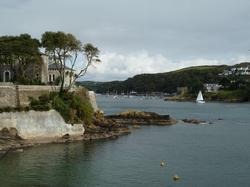 Readymoney Cove Readymoney Cove The South West Coast Path is within easy reach of Cider Cottage. It can be tackled as a long distance path or in relatively short walks. Sometimes, you will need to retrace your steps to get back to the starting point. We much prefer those that can be tackled as a circular walk, such as this 6.5 mile ramble - starting from the beach at Polkerris and circling around Menabilly Wood, before emerging on the shore of the Fowey River at Readymoney Cove. In 1942, Daphne du Maurier moved from Menabilly into the house above Readymoney Cove. 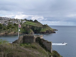 Polruan across from St Catherine's Castle Polruan across from St Catherine's Castle It is a delightful spot to linger, with its sandy beach and clear waters to cool those hot feet. Moving on a short way to the mouth of the Fowey River, you come across the remains of St Catherine's Castle. Like many estuaries along this coast, the castle was built by Henry VIII as a defensive structure to repel possible invasions by the French. Following a bracing stretch along the clifftops, the path descends to the beach at Polridmouth. 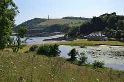 Polridmouth and Gribbin Head Polridmouth and Gribbin Head Here we met Janice and John, who were making a video of the walk for their website Walking with the Taxi Driver. Their delightful series of walks, with a Yorkshire commentary, is certainly worth enojying from the comfort of your armchair! The river valley here was flooded to create a lake to act as a decoy for Fowey Harbour, which in 1944 was bristling with 2,000 US Navy troops, preparing for the Normany Invasion. The house at Polridmouth served as the Boathouse in Du Maurier's writings, while on the distant cliff is the red and white Gribbin Tower. 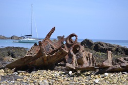 Remains of Romanie on Polridmouth beach Remains of Romanie on Polridmouth beach This 84ft tower is a daymark, erected in 1842 to assist mariners to differentiate between Gribbin Head, for Fowey and St Austell Bay, and St Anthony's Head for the port of Falmouth, whose approaches look very similar. This aid to navigation failed to help the 240 ton china clay sailing boat Romanie, however. She foundered in heavy seas at Polridmouth in January 1930 and her remains are still visible on the far beach at low tide today. The walk continues on the cliff top path around Gribbin Head, back to our starting point at Polkerris. |
New AuthorIn Feb 2021 Keith and Karen Burden took ownership of Cider Cottage whilst Lynn and Peter the previous owners moved closer to the sea to explore and enjoy more of a coastal life. Archives
May 2022
Archives
May 2022
Categories |